Reflections on 12d Model by Customers

As part of our amazing delegate interviews at our 2018 12d Technical Forum, we asked the question, “What do you like about 12d Model?” The answers were even better than we’d hoped…

We heard from…

Carly Smith – Alexander Symonds, SA

Dean Ostrofski – City of Gold Coast, Qld

Darren Gaunson – TABEC, WA

Peter Murray – Brisbane City Council, Qld

David Mares – Bouygues Construction, NSW

Phillip Weightman – Byrne Consultants, Qld

Watch the video to see what they said!

This kind of feedback is what has always driven us to strive for greater and greater service, and constant improvements to our products, over nearly 30 years of providing these to the AEC industry.

So many of our clients have been using 12d products for decades, and their loyalty and enthusiasm is our greatest treasure.

We look forward to hearing more feedback and suggestions from customers – feel free to send your thoughts to info@12d.com at any time!

Engineering Surveying Steering Group

12d Model and 12d Synergy user Michael (Mick) Connor of Fulton Hogan has been very busy in recent months! Not only is he an integral part of the team that’s made the Sydney B-Line Bus Project a reality, he’s managed to fit in a great webinar – ‘12d Synergy and 12d View for Surveyors’ as part of our popular Industry Solutions series (check out the link if you missed that one http://bit.ly/2K7fJdo).

And now he’s found yet another exciting new project…the formation of an Engineering Surveying Steering Group – a panel, including client representatives, surveyors from across the industry (NSW) – inspired by their drive over the past three years to work towards a more robust framework for Survey delivery.

They are currently running quarterly sessions, and would like to extend to interested parties an invitation for Friday 14th December.

They have representatives from RMS, TfNSW, and 12d Solutions coming along to this session, as well as Gaby Van Wyk (SSSI) who can talk through the revised AS5488 (SUI Guidelines).

12d will showcase some mapping and attributing smarts which can be aligned with SUI 5488 and G71 requirements.

Due to an overwhelming response to this concept, the Survey & Spatial Sciences Institute (SSSI) has expressed interest in sponsorship/endorsement. The team is currently awaiting venue availability, so contact Mick on Michael.Connor@fultonhogan.com.au today to book in and you’ll receive all details as they become available!

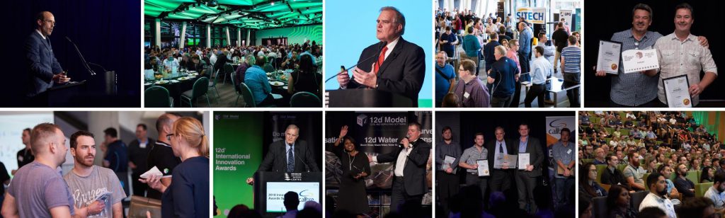
12d Innovation Awards 2018 – Tech Forum Delegate Feedback

In the wake of three successful 12d International Innovation Awards, 12d Solutions was pleased to announce the 12d International Innovation Awards 2018.

The 12d International Innovation Awards recognises inspired thinking and innovative solutions in civil engineering, surveying and data management. Around the world, our industry faces challenging problems and finds inventive answers. The 12d International Innovation Awards highlights some of the best of those solutions.

Entries closed at the end of April 2018.

The Overall Winning Team – from Arup – received $A3,000, the 12d Innovation Winner Trophy and a Full Technical Forum Package for the 12d International Technical Forum 2020, plus a $A1,500 training package. We will also select an individual to be on the judging panel for the 2020 Innovation Awards.

The Design & Visualisation Winner (or winning team) – from Aurecon – received $A1,000 cash and $A1,000 in Training, and a trophy.

The Survey & Construction Winner (or winning team) – from Tatras Consulting – received $A1,000 cash and $A1,000 in Training, and a trophy.

The 12d Water Winner (or winning team) – from WSP – received $A1,000 cash and $A1,000 in Training, and a trophy.

The Customisation Winner (or winning team) – from J. Wyndham Prince -received $A1,000 cash and $A1,000 in Training, and a trophy.

The ‘Banishing the Drafting Demon’ Winner (or winning team) – from Mackay Regional Council – received $A1,000 cash and $A1,000 in Training, and a trophy.

The 12d Synergy Winner (or winning team) – from BG&E+Cardno JV – received $A1,000 cash and $A1,000 in Training, and a trophy.

We also awarded Highly Commended prizes for each category, and certificates were awarded for the top entry from each of these business types:

  • Small
  • Medium
  • Large
  • Government

Award Winners and Highly Commended entries were showcased at the 12d International Technical Forum 2018, and are to be published on our websites, with selected entries being turned into case studies for industry media.

See our website for further details on the winners.

While we were at the 12d Technical Forum 2018, we chatted to some delegates about the Awards – check out this video of some of what was said!

The video begins with our Managing Director, Dr Lee Gregory, speaking about the history of the Awards, and what the Awards mean to him. We also heard from representatives from Calibre and City of Gold Coast, as well as our General Manager, Joel Gregory, who was also integral to these Awards being created back in 2012.


We’ll start taking entries for the 2020 Innovation Awards soon, so stay tuned for details!


Want to work at 12d NZ?

Company 12d NZ Ltd
Location Auckland City, Auckland
Pay & Benefits Competitive salary and company vehicle
Listed 14th November 2018
Type Full time, Permanent

About Us

12d NZ Ltd is New Zealand’s leading Civil Engineering and Survey software solutions provider. Distributing, implementing, training and supporting 12d Model software throughout New Zealand and the Pacific Islands.

About the Role

If you are in Tauranga, Hamilton or the greater Auckland region, we are currently seeking a training and support person to work alongside our Regional Manager. The role is based from a home office and will involve regular travel to client offices as well as the opportunity to travel within New Zealand and the Pacific Islands. The general responsibilities include arranging and managing 12d Model software implementation, training and national technical support for 12d Model customers.

The Benefits

• Work from home as part of the national team of 10
• Flexible working hours – no competing with traffic
• Competitive salary
• Company vehicle

This Role Includes

• Maintaining relationships with existing and potential 12d Model customers
• Performing demonstrations and presentations on 12d Model capabilities and benefits
• Phone and email technical support
• Software installation and implementation at client workplaces
• Training 12d Model software functions, initially within the client’s area of expertise, but growing to include any number of other Civil Engineering and Surveying applications.
• Frequent local and occasional international travel

Required Skills

• At least 3 years 12d Model experience
• Based from an upper North Island location with the opportunity to travel within New Zealand and the Pacific Islands
• Hold a current New Zealand driver’s license
• Have a competent knowledge of 12d Model’s base functions
• Be well presented and have excellent written and verbal communication skills for representing a major international software vendor.
• A good understanding of the operations of computers over and above 12d Model
• High self-motivation and time management skills
• The ability to work both independently and in team environments

Advantageous Skills

• A higher level of knowledge in Industry practices and standards
• Be an intermediate user of 12d Model
• Have the ability to present to an audience with confident public speaking skills
• A reputation within the 12d Model community
Applicants for this position should have NZ residency or a valid NZ work Visa.

12d Technical Forum 2018 – Delegate Feedback Videos

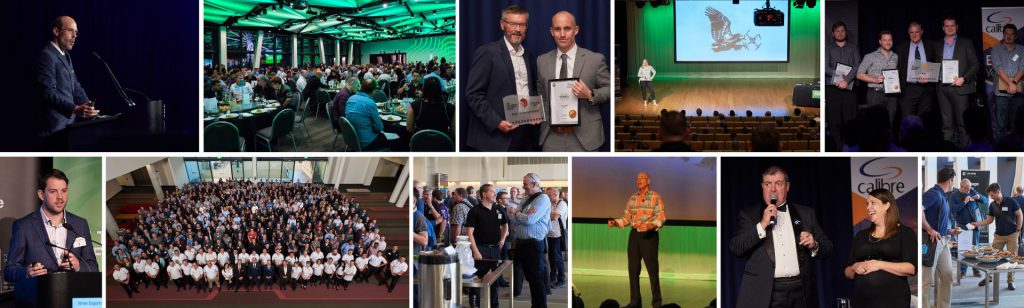
When the idea was presented to set up a stand at the 2018 Technical Forum (which was held at Brisbane Convention and Exhibition Centre in July) to chat with delegates about the event, our products…”life, the universe, and everything” (to quote the sublime Douglas Adams)…we knew it was a good one, but we had no idea just how good it was going to be!

This post is the first in a series about those informal interviews; we’re excited to present them to you!

We’ve compiled some of the feedback we had about the 2018 Technical Forum, starting with a chat we had with our Managing Director, Dr Lee Gregory, about these events, which began (as Conferences) way back in 2005.

We also spoke to representatives from Gold Coast City Council, TABEC, Horizon Surveys, GHD, Alexander Symonds, Byrne Consultants, WSP, Arcadis, Calibre, Brisbane City Council, and Bouygues Construction…with bonus content from 12d General Manager Joel Gregory (whose 18 month-old son, Lachie, made his Technical Forum debut this year!) and Lane Irwin of 12d NZ!

Networking was high on the list for most delegates we spoke to – the chance to meet 12d staff and resellers in person, and to liaise with users from all over the world, is something that just can’t be replaced by any number of remote experiences.

We’re absolutely thrilled that this Technical Forum was so well received, and we’re already making plans for the 2020 event, which will be held back at the Brisbane Convention and Exhibition Centre from 2-4 August 2020!

Watch a compilation of the positive feedback we received at this enormous event!

Demystifying Track Terminology

Lisa Stewart caught up with Alisdair McCrudden of 12d WA for a chat about the terminology surrounding 12d Track, our rail module (available free to customers on Maintenance who have purchased both the Detailed Alignment Design module and the Volumetrics and TIN Analysis module). Alisdair’s aim was to ‘demystify’ this terminology, and indeed some of the processes involved in rail design, which he maintains is not too different from road design. Alisdair says a competent road designer will easily switch to rail design with the guidance of a rail engineer or experienced rail designer.

Alisdair took us through some of the commonly used terms encountered in 12d Track (and rail design in general), including:

  • Rail
  • Sleeper
  • Ballast
  • Capping
  • Formation
  • Gauge
  • Cant
  • Pandrol Plate
  • Cross over
  • Turn-out
  • Curve Compensation

Alisdair also took us through an example of a Snippet being used to produce a decisional cut and fill template, including what can go wrong and how to fix it.

Watch Alisdair’s full presentation here:

The Technical Preview Version of 12d Model 14 is already in use by many of our customers on Maintenance who attended this year’s 12d Technical Forum…stay tuned for details of our 2020 event (2-4 August 2020, back at Brisbane Convention and Exhibition Centre) if you want to get in the loop early for 12d Model 15 as these lucky folks have done this time around!

Click here for training in your region: https://www.12d.com/training/index.html

Point Clouds at Brisbane City Council

Peter Murray spoke to our 2018 Technical Forum delegates about Brisbane City Council (BCC)’s use of Point Clouds in 12d Model software.

Peter works in the Surveying area of BCC, which is actually run as one large local authority covering the whole city; it’s unusual in that sense. It’s the largest local authority in Australia, by both budget and population (it covers a population of around 1.2 million and an area of 1,367 square kilometres). It works to an annual budget of around $3.1 billion – to cover traffic management and infrastructure, public transport, parks and opens spaces, economic development, and lifestyle and leisure. This leads to a great deal of variety in work – large projects and many smaller ones as well.

There are nearly 8,000 people working in the organisation. In Planning and Design, there are nearly 350 people – surveyors, road designers, drainage designers, bikeway designers, Geotech, pavement designers, landfill management, GIS, architects, landscape architects, water management, flood modellers, urban planners, and environmentalists.

What is a point cloud?

A point cloud is just a huge collection (thousands-billions) of points – they’re unrelated despite looking like they’re related. The enormous scale causes issues – bigger projects lead to more things that can go wrong. Point clouds have been in use since the mid-1990s…which gives some pause as to whether they’re still as relevant as they’re sometimes deemed to be.

How do we acquire point clouds?

A point cloud can be generated by laser scanning (e.g. Terrestrial, Mobile, Aerial), via photogrammetric techniques (e.g. UAVs), or using SONAR (e.g. Hydrographic Surveys).

Why do we use point clouds?

They appear to be very detailed and intuitive – they look almost like photographs (and it’s possible to measure between the points), which makes people think they’re loaded with useful information. Point clouds can also be captured rapidly and at a relatively low cost (particularly using LiDAR – this can lead to being able to capture, within days, huge amounts of information that would otherwise take surveyors years to collect). They allow for measuring of areas with difficult access, allowing for increased safety in areas such as freeways and dangerous industrial areas (e.g. through use of drones). And they’re intimately intertwined with BIM, which makes them unavoidable, especially as they become more and more mainstream and accessible to a wider audience.

What are the potential downfalls of using point clouds?

Highly specialised skills are required to produce a high-quality point cloud. The size of the datasets required is also prohibitive. It is also an issue that point clouds don’t fit well with traditional design processes, and are technology hungry – a variety of sophisticated equipment is required for their successful use.

How do we collect the datasets for point clouds?

  • LiDAR – used since about 2010 by BCC for flood plain modelling, concept designs, investigations, and volumetric resumptions, LiDAR is regularly incorporated into their workflows and is an accepted data source. Data is generated by a plane flying over the ground with lasers pointing below and measuring downwards. As the lasers hit the ground, the beams are reflected back up to the plane so the plane can take measurements, at a rate of about 2 million measurements per second! Unfortunately, vegetation and water are the ‘natural enemies’ of LiDAR, so it can’t be used everywhere. Over time, their teams have learnt that not every point is required, nor is every point reliable…and unfortunately it isn’t always possible to pick the reliable points by inspection.
  • LAS files (which have evolved from LiDAR) with categories, which are generated when reflections bounce off g. leaves and trees, leading to greater ability to filter out extraneous information, determine roof heights, interpolate floor levels, etc. LAS files are very useful in particular circumstances, and are included (with accompanying macros) in a number of BCC workflows.
  • The new ‘Point Cloud Surface Thinning’ option in 12d Model 14 – a very neat function allowing draping of strings through point clouds. This means points can be concentrated where changes in grade occur, leading to a reduction in ALS points. The result is better-looking contours which are closer to the original…at 12% of the size of the original dataset.
  • UAV LiDAR using drones – this can be great for working in what would otherwise be very dangerous areas.
  • Mobile Laser Scanning – this is more accurate and less expensive than LiDAR, but also more difficult to control.
  • UAV Photogrammetric Point Clouds – this method is quick and inexpensive, but again there are issues with control.
  • Terrestrial Laser Scanning – BCC had experience with this years ago, for bridge scans. Using this method, small amounts of important information can safely be obtained.

What they have learnt at BCC

Overall, point clouds are an efficient and practical way of collecting a dataset. It is important to remember that not all the points are needed, and that not all clouds are the same. Also, file extensions are not a reliable indicator of contents – there are standards in existence, but they are not always followed. Peter also cautioned against such marketing claims as ‘Scan to BIM capability’ as they are not always what they seem.

Some of the point cloud outputs include a full point cloud (which is a good record of what was there), extracted objects, vectors and points, surfaces (TINs), and viewers. These can be used in such areas as geospatial, forensics, and film.

Point cloud functionality in 12d Model

Peter said there is definitely value in point clouds, but they’re not yet civil design ready, at least not universally. 12d Model manages point clouds well, though – it will read them in with ease.

12d Model will import common formats of point cloud, convert between formats, and perform projection transformations. It uses a ‘String_cloud’ element. In 12d Model 14, these processes have been improved even further – there is now capability to import multiple files, selected in Perspective view (which has also been made more responsive and reliable). Threaded views have also been added.

Peter also outlined some of his favourite point cloud functionality in 12d Model – including manipulating categories, deleting/undeleting, draping against point clouds, drawing flags, limiting clouds, pinning clouds, and of course the aforementioned Point Cloud Thinning.

Where to now for BCC and point clouds?

As they’ve now reached such a level of success with LiDAR point clouds, they’re now looking at scanning drainage chambers, scanning buildings, and data extraction and modelling (including vectors, trimeshes, and pipes). Peter showed examples of terrestrial laser scanning they’ve done (in particular with manholes). He has been investigating ways to utilise point clouds, including a macro (within 12d Model) to slice them, meaning he could extract a trimesh out of a point cloud to reduce it to a manageable number of points. By colouring the trimesh, surrounding spots have been made visible, and the clouds have become more valuable in his day-to-day work. By combining an image and a point cloud on some other projects, further usefulness has been discovered.

BCC has been developing a specification for the extraction of trimeshes from point clouds, as well as mapping files and 12d Field codes. They have utilised DTM auditing routines for trimeshes. Recently they purchased a BLK 360 scanner, and they are working on developing in-house skills to take their use of point clouds even further.

In essence, keeping full point clouds is a good way of maintaining an accurate record for future reference, and with some ingenuity, their day-to-day usefulness can be harnessed on some projects, too.


Watch Peter’s talk here: http://bit.ly/2PcZW2x

Complete Design Documentation on the Parramatta Light Rail Project

Niall Brady (Digital Engineering Lead) and Jarred Dickson (Senior Highway Engineer) of Arup Sydney addressed the delegates of our 2018 12d Technical Forum recently about an exciting project they’ve been working on – Stage 1 of the Parramatta Light Rail.

The Client for the project is Transport for NSW. Stage 1 of the Parramatta Light Rail will connect Westmead to Carlingford via the Sydney CBD & Camellia. It will consist of a two-way track spanning roughly 12km, with both on-line (through urban streets) and off-line sections. The track is due to open in 2023.

Parramatta is in the west of Sydney. The areas that were discussed in this presentation are Enabling Works Packages in Sections 1 and 2 – along Church Street and O’Connell Street (moving traffic off Church street onto O’Connell Street to allow for the construction of the light rail), and Section 3 (along George Street – moving traffic off Macquarie Street onto George Street and changing George Street from one lane to two in each direction). This will also involve a section along Hawkesbury Road – adjacent to the upgrade of Westmead Hospital.

The scheme is currently in the Tender Review Stage. Stage 2 has been announced and is in its early design stages.

Arup needed to be able to deliver all three Enabling Works Packages in 16 weeks – a very quick turnaround – to submit to a contractor to be constructed before the main works commenced. It was necessary for a high level of Digital Engineering to be applied. This led Arup to develop a 3D Federated Model, applying Work Breakdown Structure and Naming to enable 4D BIM Cost, 5D BIM Cost, and 6D BIM Asset Management. They also used a model for Design Coordination and Stakeholder Engagement.

So what is Digital Engineering? According to Arup, it is a “collaborative way of working using digital processes to enable more productive methods of planning, designing, constructing, operating, and maintaining assets. This is achieved by creating a Common Data Environment (CDE) that aligns digital information systems – including CAD, controls (time, cost, risk, etc.), asset data, and other data systems.”

Digital Engineering in 12d Model

The design tools the Arup road design team used to reduce the amount of rework, documentation, etc., and ideally get design right first go, included:

Smart Snippets

The team tried to limit the number of manual inputs into Snippets that could result in errors, so the Snippets had the code embedded or hard-coded in, or referenced project details, attributes, etc. to create consistency across the project. The theory was that if the design models are consistent, the output models should then be consistent.

In addition to design elements, they drew upon other Snippets – e.g. vertical clearance envelopes, modelling clear zones within 12d (this meant they could design barriers on the fly without needing a review process afterwards). Other disciplines were also using these outputs – e.g. clear zones to landscaping teams so they knew what they could plant where.

Snippets worked in the background to embed attributes into trimeshes, so when they sent IFC models out to other packages, they could interpret the designs straightaway without asking questions – this sped up coordination between disciplines.

Smart Chains

Standardised/transferable chains. One source meant one chain could be run multiple times, taking advantage of parameter files. This meant they could make tweaks to outputs easily and then get consistent outputs across disciplines and packages.

The team also filtered 12d data to geographical regions and attribute data, and used this to connect models across all systems to apply cost and time for construction.

They took that a bit further and, rather than using chains with parameters, they wrote macros (e.g. Automating Road Furniture – Line Marking, Kerbs, Traffic Signs, Scheduling; Design Verification – Aquaplaning; Design Verification – Swept Paths, Sight Lines – for e.g. mapping 3d survey model to actual 3d objects, HGL to Trimesh) – this mean they didn’t need to upskill others on parameter files; the macro provided a user-friendly interface. This saved a lot of time in documentation, training, etc.

All this was done “on the fly” (including conformance checks) so there was less checking at the end.

Utility Coordination

Utilities are critical, especially in an inner-city environment – they can be high-risk on projects such as this. The Arup team worked with transport and other consultants to set up a better process for coordinating utilities.

The UUS Schema, Utility Specification, Surveyed Information, and DBYD (GIS Data) were read into a 12da file (single source of information), which then populated the Navisworks 3d Model, GIS Portal, and 12d Model, which in turn created the Utility Design, Rail Design, Drainage Design, and Road Design.

The Utility Schema was based on the AS 5488 Classification of Subsurface Utility Information (SUI). Additional attributes were added and standardised to simplify GIS setup, 12d Mapping (long sections and cross sections), and Federated Models properties. Every utility had approximately 70 attributes for type, clash, risk, and treatment.

Utility Coordination – 12d Workflow:

  1. Digitise the Dial Before You Dig data in 12d Model
  2. Identify additional utility survey required
  3. Import 12da file from Surveyor
  4. Apply unique ID (GOID) using a macro
  5. Apply attributes using a string filter
  6. Apply remaining attributes from Register
  7. Apply attributes from mapfile
  8. Apply pipe diameter from ‘pipe size’ attribute

All this was automated in a Standardised Chain

  1. The model was then exported to IFC for GIS and Federated Models

The team was pleased to note that when you select a string in 12d Model and view its properties, you can take that forward and see that exact information in the GIS Portal and in Navisworks; this powerful functionality was a great help to them on this project. Their deliverable was a full set of drawings – longitudinal and cross sections, so there was much to be done.

The GIS Web Platform doesn’t require software – users can just click on the utility portal. They were also able to provide access to contractors.

Federated Model – IFC Files

Along Hawkesbury Road, a number of different consultancies, as well as disciplines, were involved. These were brought together in 12d Model. All files were exported as IFC.

Arup delivered this entire detailed design in just 16 weeks. They delivered the 3D BIM model with attributes for 4D, 5D, and 6D, as required. They also delivered a full set of drawings for all disciplines. This was all done with a small full-time team – 3 engineers, 1 designer, 1 CAD person. By using a model in stakeholder engagement and speaking frequently to client RMS they reached ‘Agreement’ on departures (trees in clear zone/sightlines).

They could not have achieved these results without 12d and adopting Digital Engineering processes.

Fulton Hogan on 12d View

I caught up with Michael (Mick) Connor – Survey Manager at Fulton Hogan – about his team’s use of 12d Model with 12d View (and 12d Synergy). This webinar was based on a presentation Mick delivered at our 12d Technical Forum in July.

Mick has over 19 years’ experience in surveying, so we definitely value his opinions on such matters! Fulton Hogan is a large infrastructure, construction, roadworks, and aggregate supplier company in New Zealand, which is also active in wider Australasia. The company was founded by Julius Fulton and Robert Hogan in Dunedin in 1933 (Source: Wikipedia).

The Sydney B-Line bus project has revolutionised bus travel along the Northern Beaches and Lower North Shore into the northern end of the CBD. Such an ambitious project presented certain challenges, including narrow corridors, especially through Neutral Bay and Cremorne, where roads are congested with utilities.

With the help of 12d Model with the 12d Viewer (12d View), Mick and his team were able to alleviate the strain of such an enormous project detracting from their day-to-day work. When their engineers were able to harness the power of 12d View for their utility analysis, time, cost and quality benefits ensued, meaning the engineers involved in the project were afforded greater ownership and accountability, leading to a greater sense of empowerment. In turn, this allowed Mick to gain back some much-needed time each day, because he no longer needed to oversee other processes as much.

12d View screenshot

Mick said the installation process for adding 12d View was simple. Then once he added it on, he simply ran a Chain to output the models he needed on a weekly basis, and the designers would just read that in using drag-and-drop.

To hear more about how this innovative team uses 12d products, watch the video of our latest Industry Solutions webinar!

Fulton Hogan Website

–Lisa Stewart

12d View for Surveyors

Michael (Mick) Connor – Survey Manager at Fulton Hogan – will chat with me on 31st October at 1pm about his team’s use of 12d Model with 12d View (and 12d Synergy). This webinar will be based on a presentation Mick delivered at our 12d Technical Forum in July.

He’ll take us through their journey, and what they encountered on a recent important project – Sydney’s B-Line, which has revolutionised bus travel along the Northern Beaches and Lower North Shore into the northern end of the CBD.

Some of the challenges they encountered on this project included narrow corridors, especially through Neutral Bay and Cremorne, where roads are congested with utilities.

The Fulton Hogan team worked through the night most nights to minimise disruption to users of the existing network until the new one could be launched.

Mick found that the enormous project was detracting from his day-to-day work, and he needed to find a better way to do things. Enter 12d Viewer.

Using this innovation in 12d Model, Mick’s team saw time, cost, and quality benefits, leading to greater empowerment for the engineers involved in the project – it allowed them ownership and accountability, and in turn this allowed Mick to achieve more with his days because he no longer needed to oversee other processes as much.

To hear more about how this was achieved, register to attend our free Industry Solutions Webinar at 1pm (Sydney time) on Wednesday, 31st October, 2018.

–Lisa Stewart