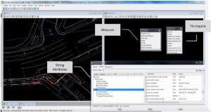
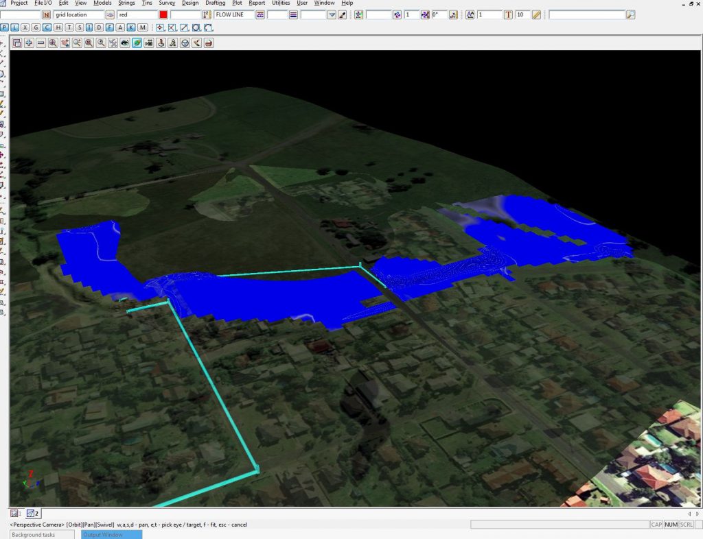
12d View allows 12d Model customers and non-12d Model customers to view 12d Model projects and aggregate other industry data in a single 3D platform. 12d View is great for engineers, staff onsite who want to view civil data in 3D or anyone who doesn’t have access to a full 12d Model licence and wants to view 3D data.
We chatted with Michael (Mick) Connor – Survey Manager at Fulton Hogan – about his team’s use of 12d Model with 12d View (and 12d Synergy), especially on the Sydney B-Line bus project. Mick has over 19 years’ experience in surveying, so we definitely value his opinions on such matters! Fulton Hogan is a large infrastructure, construction, roadworks, and aggregate supplier company in New Zealand, which is also active in wider Australasia. The company was founded by Julius Fulton and Robert Hogan in Dunedin in 1933 (Source: Wikipedia).
The Sydney B-Line bus project has revolutionised bus travel along the Northern Beaches and Lower North Shore into the northern end of the CBD. Such an ambitious project presented certain challenges, including narrow corridors, especially through Neutral Bay and Cremorne, where roads are congested with utilities.
With the help of 12d Model with the 12d Viewer (12d View), Mick and his team were able to alleviate the strain of such an enormous project detracting from their day-to-day work. When their engineers were able to harness the power of 12d View for their utility analysis, time, cost and quality benefits ensued, meaning the engineers involved in the project were afforded greater ownership and accountability, leading to a greater sense of empowerment. In turn, this allowed Mick to gain back some much-needed time each day, because he no longer needed to oversee other processes as much.
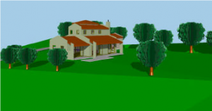
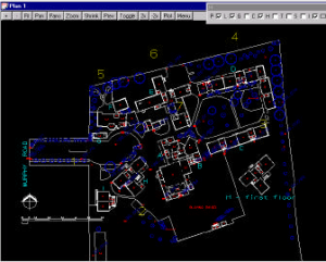
12d View screenshot
Mick said the installation process for adding 12d View was simple. Then once he added it on, he simply ran a Chain to output the models he needed on a weekly basis, and the designers would just read that in using drag-and-drop.
I caught up with Peter Taynton of 12d Queensland for Episode 1 in a new webinar series!
This first session focussed on the object types shipped with 12d. There was a generalised discussion on how the objects were created, along with some editing:
• File structure
• Vertex objects
• Segment objects
There was also a discussion on how the objects are applied:
• Attributes
• Tin Interface
• Regular Vertex & Segment interval
There will be follow-up webinars that will focus on some particular applications of the BIM objects – details to follow!
Watch a presentation given by Peter Ryan (Jacobs, Technical Director, Digital Engineering) at our sold-out 2018 12d Technical Forum. Learn about the challenges, workflows and benefits of designing the M1/M3/Gateway project under Civil BIM, and how 12d Model and 12d Synergy enabled this.
What is the M1/M3/Gateway Merge?
This is a BIM project being led by Jacobs’ 12d Civil teams. Where some of the bigger projects may rely on multiple products, M1/M3 allowed Jacobs the opportunity to use 12d Model as their primary authoring tool, and really test the benefits BIM promises to deliver, and apply it to a more traditional Queensland Department of Transport and Main Roads (TMR) highway project.
Where is the M1/M3/Gateway Merge?
The project is located south of Brisbane, at the intersection of the M1, M3 and Gateway Motorways. The M3 is the main arterial out of Brisbane to the south, while the Gateway is the primary bypass of Brisbane – it takes all the traffic from the Sunshine Coast and ultimately connects to the Bruce Highway in the north. The M1 services all destinations to the south, including the Gold Coast, connecting to motorways all the way down to Sydney.
What does the project entail?
The project includes the widening of the southbound carriageway to three lanes for a section of 3.8km, as well as the realignment of that carriageway to provide a five-lane cross-section where the Gateway Motorway comes in. This will allow for future works on the northbound carriageway. They are also building a new bridge over Underwood Road – this is being constructed adjacent to the existing bridge and, when finished, will span the five traffic lanes. They are closing a bus entry from the existing Eight Mile Plains busway station, and constructing a new bus on-ramp at School Road. Throughout the site, Managed Motorways Technology is being used. The project is being delivered as a design and construct, with Jacobs providing all the design services to the principal contractor, Lendlease. 12d Model has been utilised for all the civil design elements of the project.
What are they trying to achieve?
The principle aim of this project is to reduce congestion and improve safety at the junction of all these Motorways. This project is the third BIM Pilot project for TMR. The Lendlease and Jacobs BIM offering has been developed from experience delivering recent major projects in South East Queensland, including the Gateway Upgrade North (GUN) and the Kingsford Smith Drive Upgrade (KSD).
What roles are involved?
The first thing the team did upon commencing this project was to define new roles related to the BIM work that was required. Peter Ryan was introduced to 12d Model in the 90s, so he was the natural choice for one of the Digital Engineering Leads, responsible for defining processes and workflows. They also assigned the roles of Discipline Model Manager (responsible for coordinating model authoring and output) and BIM Manager (responsible for model federation). The BIM Execution Plan aligns with the objectives of each party (Jacobs, Lendlease, and TMR).
TMR’s BIM Objectives
understanding what is reasonably achieveable for designers and contractors using current technology, and what challenges they face
assessing whether the requirements of the BIM Functional Spec are appropriate, and whether any would pose an unnecessary cost
continuously improving clarity in the BIM specifications through collaboration with industry partners
developing an internal TMR skill set for electronic delivery and review
assisting the industry to deliver the ultimate TMR objective of a LOD500 object-based as-built model.
Lendlease’s BIM Objectives
avoiding duplicate modelling effort for construction setout
identifying clashes before construction
using the 3D model to assess safety during construction
educating the construction team to understand the scope and status of work in progress
using the model to assess constructability and simulate 4D sequencing scenarios.
Jacobs’ BIM Objectives
collaborative 3D coordinated design for all disciplines
use of 3D models to review design in the virtual environment
providing string setout to suit construction requirements
providing confidence in the quality of electronic data handover
embedding BIM workflows as ‘Business as Usual’.
Inherent to this were challenges such as balancing increased upfront design effort while delivering to program and budget.
To find out how the Jacobs team overcame this and other challenges, watch Peter’s presentation today!
Subtitle: Digital Transformation in the Civil Infrastructure Industry
As data managers, Surveyors are faced with many challenges, and are responsible for ever-increasing spatial and metadata information sets. Much of this data is of a basic xyz nature, without attributes or QA information.
Presented by 12d Field Product Sales Manager Graham Wirth, this presentation is derived from the shared experiences of Surveyors, over the past 25 years. The evolution of the surveying industry has been explosive. With the advent of GNSS, Motorised Total Stations and Scanning, positioning productivity initially outstripped the digital computing ability. The past decade, however, has seen improvements in digital capture and Design BIM modelling. We’ll explore the difficulties surveyors have experienced when setting out design solid models. Initially, designs using BIM or solid modelling were restricted to building structures. This format is now becoming the norm across most structural infrastructure designs – Surveyors’ traditional use of line and point positioning technologies needed new methods to manage setout of solid design models.
This presentation demonstrates new digital tools that assist Surveyors with this process. Using the IFC BIM data exchange format, Surveyors are able to import solid models traditionally referenced at a 0,0,0 coordinate location, convert to metres, and – using 2D and 3D transformations – bring models into real-world geodetic positions, as used by Surveyors. With the IFC format ability, Surveyors can separate the structure elements critical to setout requirements, such as footings, slabs and columns. These solid elements can then be broken down to the points and lines for setout.
This is only half the story, as the use of IFC and solid modelling comes full circle to provide designers, clients and government bodies the structural BIM model of as-constructed buildings and structures, complete with attribute and meta data required to meet industry standards.
When Frenchs Forest-based surveying firm ESO Surveyors won the contract to perform the quantity surveying on Sydney’s new International Convention Centre (ICC), they jumped at the chance. They had previously made the transition into buildings, and the challenge of such an interesting space appealed. The project was completed in conjunction with Robert Bird Group (for the structural engineering), Hyder Consulting (for the civil engineering), and Lendlease Group – the main contractors.
This important Darling Harbour redevelopment involved three conjoined key structures: the ICC Sydney Theatre, the ICC Sydney Exhibition Centre and the ICC Sydney Convention Centre. The buildings contain a variety of event spaces. The space opened in December 2016. ESO used 12d Model software for all their 3D modelling, as-builts, etc. on the project. Surveyor Greg Cech said, “12d was a good program to check how the design looked.” In fact, according to ESO General Manager Campbell Blogg, the firm now uses 12d Model across the board on all their projects.
12d Model creators 12d Solutions Pty Ltd were very interested in this application of their software, according to their CEO Dr Lee Gregory, who declared “That’s not what you’d normally think of with 12d Model; most people associate the software with roads and the like.”
Greg said, “Using 12d Field is handy for buildings because you can have all your grid lines set up as separate layers – turn them on, turn them off…have the controls set up as your separate layers so that you’re able to use that as an easy way to control the whole job.”
This video demonstrates the many features of the Drainage Plan Plot PPF Editor, and the example PPFs installed in the library folder in 12d Model.
Techniques for producing outputs for multiple drawings with different frame rotations are shown, on the way to producing PDFs of drainage plans.
The Drainage Plan Plot PPF Editor is unique among the PPF Editors in 12d Model, and some of its non-plotting applications are also discussed.
Presenter Owen Thornton has been writing software for 12d Solutions since 2003. Owen has 15 years’ professional experience in the civil and mining industries. He is the original author of the 12d’s Drainage Network Editor and the Drainage Analysis module and is a 12d specialist in drainage, utilities, plot parameter files, survey conformance, volumetrics and system setup. Owen has recent consulting experience using 12d Model on a variety of large projects. These days, Owen also gives regular 12d training courses in drainage design and macro writing.
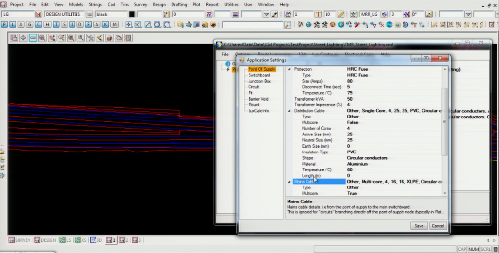
Sudharsanan Loganathan of the Department of Transport and Main Roads, Queensland (TMR) spoke to our Technical Forum audience about a lighting module in 12d Model he’s been working on. It includes some tools to help designers produce models, and specifically to create consistency in processes and improve the as-constructed.
Background
Managing assets was vital to his team – they’re now doing more with what they’re given. They focussed on improving processes and efficiency. Implementing BIM has been very important. The lighting package is an R&D project to improve these processes.
Lighting was chosen as a test case because it leads to significant benefits – it’s still in the 2D drafting stage, so making it 3D helped a lot. It was also low risk in terms of dollar values – it’s easier to shift lighting than, say, a bridge! Points and linear assets are dealt with at the same time.
It was a big change for their electrical designers to come back to a modelling space. With road operations moving more and more into this space – self driving vehicles, etc. – they need their information and assets all in right spot; there’s no room for errors/omissions.
Benefits
The main objective was to clarify the handover requirements from the TMR side – they need to build something, but what does the client actually want, in detail?
Other benefits included:
Minimising hard copy drawing requirements at handover
Minimising manual processes
Minimising duplication
Improving information management
Providing data validation
Improving quality and consistency of ‘As-Built’ information.
Project Life Cycle
Planning – single source required
Design
Construction
Finalisation
Asset Management (also archiving, etc.)
Components of the Lighting Module
Lighting Schema
User interface to help create a valid data file (xml format)
What can we do to shape a better world? Charity, the environment, education, and health all spring to mind as areas to focus on…
Since its humble roots back in 1988, sitting in (literally) a basement to sell the first licence of 12d (then 4d) Model, 12d Solutions has held dear these Company Values:
Quality Team-work
Change Achievement
Customers People development
Excellence Integrity
This last one is possibly the most important. We believe we have a moral responsibility to help make the world a better place, in any small way we can, and to always stay true to our core values. As individuals, this responsibility begins, but when one has the capacity to help make bigger changes…that’s an absolute must. And we try to do that through 12d products whenever we can.
Charity
They say “charity begins at home”…but it doesn’t have to end there.
Some of you may be aware that 12d Solutions often lends software to groups doing Charity and Not for Profit work. One such user is Shane Elson, a Bundaberg man, who is working in Kalimantan as the Director of Innovative Solutions Indonesia.
Shane recently updated us on what he has been up to…
Because an extensive survey was unavailable for this project in Martapura, South Kalimantan, Shane and his team were unable to do full 2D drainage modelling but they were able to import the existing local survey into 12d Model and produce a solid 1D drainage model using ILSAX2 and some included basins.
To do the drainage properly data for the existing road was required but given the lack of existing road profile, Shane designed a new road at a very similar height to the current road (so pit levels were close to existing).
In the end, the design was approximately 4km of road and 6km of drainage network including pipes, open channels, basins, etc.
It is safe to say that the city (and most likely, in fact, the state) has never seen a detailed design like this before. Shane’s team used this project for education, and to open the locals’ minds to what is possible.
Shane also commented that he is now “much more thankful for the access to high quality surveyors I had in Australia. A good survey is foundational to a good design!”
Shane also ‘stretched himself’ and learned to use the Visualisation module through the 12d Model YouTube channel, to the extent that he could give the government a sense of what this infrastructure could look like if it were built to a standard.
The government now wants Shane’s team to finish the design of the road and build it as well, but there are potential issues with local business owners that could make this next stage difficult due to building in the road reserve without the necessary permissions (this is normal).
Of their use of 12d Model on this project, Shane told us, “We are using 12d Model to catalyse vision and change for the people. As always there is some resistance but the government is very keen and already talking about buying a licence of their own. We are also talking with the largest university in the state about implementing 12d Model there.”
Shane says it looks as though 2019 will bring even more opportunities to develop standards using 12d Model, with another drainage study needing to be done. His team’s hope is to be able to do 2D drainage models, but it will again come down to survey. They are looking into a drone that can perform local LiDAR, and are talking to the local government about the possibility of doing this.
Shane’s local business partner absolutely loves using 12d Model, and will be trained more comprehensively in it this year along with other local employees. To add to his credibility, Shane just received his Indonesian engineering accreditation at the highest level, to go with his CPEng, RPEQ and FIEAust.
This is such an exciting partnership, and both Shane’s team and the team at 12d Solutions look forward to its continuation.
We have a long history of charitable donations as well, and when natural disasters have struck our customers (such as during the Queensland Floods, and the Christchurch Earthquakes, in 2010-11), 12d replaced any dongles lost in these disasters free of charge. Because it was the right thing to do.
Environment
From 12d Model 9, we’ve had the 12d Field modules as part of 12d Model. While at a glance it didn’t seem like this was something that would automatically assist with environmental concerns, we discovered from talking to clients that it did just that.
Survey teams at an ever-growing number of 12d customer sites have combined the use of 12d Field out on site, and simultaneously linked to 12d Model projects and GIS data stored back in the office.
12d Field is a 12d Model module designed to give Surveyors and Engineers the ability to use the full functionality of 12d Model on small daylight-readable tablets and notebooks whilst out on site.
The power lies with having 12d Model and 12d Field as part of the client’s software suite. Clients then have the freedom to work with entire 12d projects either in the office, or remotely on site and send information back to designers and GIS officers in the office. (and vice versa).
Entire 12d projects can be easily connected to and setout with survey accuracy, all without having to drive back to the office, and more importantly without relying on static data import/export. The connections to 12d projects and GIS data allow seamless integration for the surveyor and designer.
One client estimated the reduction in CO2 greenhouse emissions to be 676kg per year through the savings in vehicle trips achieved by being able to access data in 12d Field without having to return to the office from the site.
Another important advantage of 12d Field is that it allows the user to focus on ensuring greater project quality in a substantially shorter time frame than was traditionally possible. Survey data reductions happen on the fly and are instantly viewable on the tablet PC for error checking.
Plus 12d projects and GIS data can be easily connected to and setout with survey accuracy, all without having to drive back to the office, and more importantly without relying on static data import/export. The connections to 12d projects and GIS data allow seamless integration for the surveyor and designer.
Internationally, we are seeing companies embracing technologies that maintain quality and promote energy conservation. Ultimately, embracing such technology is also proving to help with economic profitability, so it’s a ‘no-brainer’ when it comes down to it!
We’ve also found it very important in recent years to modify our invoicing system to allow for the emailing of invoices, to help reduce our environmental footprint. And wherever possible, we like to work with ‘green venues’ such as Brisbane Convention and Exhibition Centre, where we host our biennial Technical Forums (the next of which will take place 2-4 August 2020 – register here).
12d Model has also been used on a number of wonderful renewable energy projects such as wind farms and solar farms – customers such as ESO Surveyors have led the charge in applying the technology to such endeavours.
Health
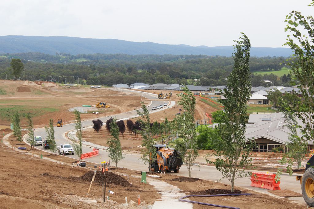
The new Northern Beaches Hospital’s surrounding road project is essential for getting people in and out for life-saving medical care.
In February we caught up with Greg Cech from ESO Surveyors, who is currently employed as the Survey Manager on the Northern Beaches Hospital road infrastructure job. Greg has been on that project for two and a half years, and it was going for approximately a year before he started. All ESO’s work on this project is being done in 12d Model with 12d Field.
As we drove through the project zone, which is just minutes from ESO’s lovely Frenchs Forest office space, we could see their great work in action, and just how much things are taking shape at this point.
Greg confirmed what an exciting project this is to work on, and told us a little about the masses of infrastructure underground – services and such – which of course slowed down the apparent construction for a few months, even though the actual construction was still going on underneath. He said it’s getting to a particularly interesting point from a public perspective as bridges are now being constructed, so people coming past will be able to see the bridges, as well as the slot, which is also starting to be constructed and will be a big visual enhancement in the space. The ‘slot’ is what will come out from Wakehurst Parkway; colloquially it may be known as a ‘tunnel’, but that’s not the technically correct term. Greg told us that it’s actually literally a slot that goes up to about eight metres deep, and the east-west through traffic will run in the slot. Local traffic will run up above it.
During the earlier phases of this project, there were massive disruptions to traffic through the area, but it’s now flowing much better than before. Greg said he hopes it will only get better as they get more and more lanes open up to through traffic.
All in all, a very exciting project, and one we’re proud to say 12d Model and 12d Field are being used for!
Education
12d Model is used and taught at a wide variety of educational institutes, around Australia and internationally. We give these licences to universities and colleges so that upcoming generations can be skilled in software that will help them throughout their careers. With 12d Model being the market leader in Australia and New Zealand, there aren’t many firms these young people could end up working for where being skilled in 12d Model wouldn’t be an advantage!
Over time, we’ve also had some interesting examples of 12d Model being used on projects to assist educational institutes.
For instance, in 2001, New Zealand firm Gary Pidd Architect Ltd jumped on the cutting edge of technology with its innovative use of 12d Model for an ongoing project to build a database of over 200 schools:
In 2016, Brent Gordon of Dalton Consulting Engineers (DCE) addressed our Conference attendees about an exciting project they were involved in, for educational and sports facilities at St Kevin’s College in Melbourne. DCE is a privately-owned civil engineering consultancy with a growing global footprint. They specialise in three core areas of expertise: urban development, infrastructure and sport. The college bought the 5.4ha site – one with a rich and varied history – in 2012, and had a variety of land development requirements.
St Kevin’s bought the former Coles carpark site in 2012…by bike or car it’s less than 10min from the school, so it had appeal. It’s now the largest privately owned Fully Synthetic Facility in Australasia.
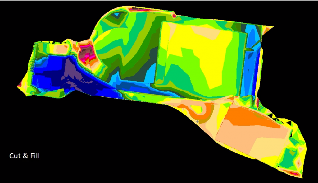
St Kevin’s Cut & Fill
This 5.4 hectare site comprises:
3 x FIFA Soccer Pitches – 100m x 60m
An incorporated AFL Football Field – 135m x 110m
FIH Hockey Field with 12d tennis courts
200m Athletic Track
High Jump Facilities
2 x Long Jump Facilities
Shot Put facilities
2 x pavilion and storage facilities
Gardiners Creek Bike Track
Design challenges for the site included:
Environment Audit Overlay
Flood Inundation Overlay
Sewer Manhole
Design Compliance
Tree Protection – so important from an environmental perspective; the team had to ensure fill material from new construction was outside the Tree Protection Overlays.
Earthworks
Subsidence
The facility opened in 2017.
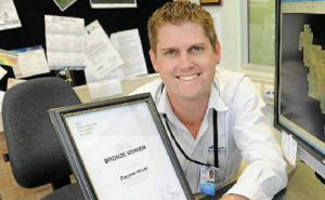
Another example we were particularly proud to be involved with happened after the 12d Model Conference in 2005, when we were chatting with Innovation Awards winner Dwayne Honor to discuss his prize and discovered that Dwayne was donating the prize money to his former high school in the rural town of Gin Gin in Queensland, to establish a perpetual award to encourage students from regional areas into science and engineering.
On top of his prize money, Dwayne donated $1,000 of his own income, and this was matched by 12d Solutions.
12d Water Resources Engineer Rob Graham is our ‘go-to guy’ for all things Drainage 2D. Watch this video to hear him talk about this exciting aspect of 12d Model!
Stormwater overland flow is a critical component of roadway design. Estimating flow paths through intersections and roundabouts can be difficult, especially under complex diverging flow conditions. 2D hydraulic modelling provides the modeller a more advanced tool for evaluating the surface flow patterns. Conventional 1D modelling requires the modeller to define the flow routes based on evaluation of the terrain and estimated flow direction (water does not always flow downhill and has a reluctance to turn corners).
In this introductory session, we use 12d Model to create a small 2d hydraulic model of a roadway intersection, run the TUFLOW engine and review the velocity, depth and hazard results. The visualisation of the results are in plan, section and 3d animation.
We caught up with David Healy – Senior Design Engineer, J. Wyndham Prince – who has been with the firm for about nine years, and in the engineering industry for about 16 years. David has been using 12d products for 14 years, across a broad range of road and drainage projects.
He and his team decided to enter the 12d International Innovation Awards 2018 because they were proud of a 12d Model macro they’d written and thought they’d see what others thought of it…and our judges confirmed just how great this macro was, by awarding them first prize in the Customisation category!
Innovation, to David, means taking something that exists and making it better, redefining it to make it more efficient – saving time is crucial for their busy firm, so anything they can do to innovate in that regard, while maintaining their high standards, is always a priority.
The main problem they had as designers was the initial set-up process – defining kerb returns, applying MTFs, etc. – which can be boring and tedious. Before the macro, the workflow involved doing all of this manually, as well as building road surfaces, setting up Chains, and plotting out PPFs. The main benefit of the solution was the time saved…designers could stay focussed on the design itself rather than on the set-up. One of their projects would have taken about 80 hours to set up, and with the macro, took just two!
This macro has given J. Wyndham Prince the capacity to take on even more work for their clients, and the extra efficiency they’d always wanted.
If you’d like to read more about how they achieved this, simply enter your details to receive the full case study as a PDF (link coming soon)!