ROADTEK Consulting Services (https://www.tmr.qld.gov.au/), led by contractor Wayne Hansen, successfully leveraged 12d Model to streamline the complete survey, design, and construction setout process for the Marburg Rosewood Road upgrade project in Queensland, Australia.
When surveyors from Queensland’s Department of Main Roads ROADTEK Consulting Services were requested to survey a road corridor on Queensland’s Marburg Rosewood Road, some 60km west of the Brisbane CBD, they elected to use 12d Model and Fieldbook 2000, which has set a new benchmark in the presentation of survey information.
Prior to using 12d Model, survey information was processed using CivilCAD or Geocomp and the project was designed using MOSS and AutoCAD. Setout for construction was always manual input from construction plans.
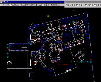
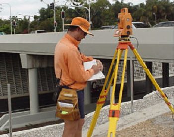
For this project, features and terrain details were captured using a Geodimeter 610 Total Station. The raw survey data was processed using 12d Model to produce the Fieldbook 2000 verification plots and the 12d ascii files for the design team.
The existing and relocated services were also provided in a 12d ascii format using ‘super string’ attributes. “On the Marburg Road construction project, Main Roads surveyors used 12d in the field for the actual setout of the control lines, drainage structures and roadside furniture,” explained Wayne Hansen, Supervising Engineering Surveyor, Queensland Main Roads.
“All this information was accessed via their laptop computers. Using macros, relevant information was converted into suitable formats for direct uploading into the survey instruments. This eliminates the chance of introducing transposing errors which could have occurred previously as all the data was input into the instruments manually,” he said.
“I believe this is the first time that the whole process has been completed using only one software package.” A part of the project in which 12d was instrumental involved replacement of an existing timber bridge over Black Snake Creek with a skewed 3/3600×2100 RCBC on a realigned section of road reconstruction. The reconstruction works involved removal of existing seal, scarifying existing pavement and spreading it to a new width and crossfall profile, and incorporating additional pavement material to provide a finished full-width seal 100mm higher than the existing one. The design also required realignment of two intersections.
Drainage was also updated using 12d Model to determine excavation quantities and 12d stream x-sections were used to calculate stream tail water depths. The software was used to measure power pole distances to the new edge line which was used in the process to determine relocation works of power poles from the clear zone. 12d Model provided all required outputs to enable service conflict locations to be priced and relocated prior to construction.
Service Super Strings enabled any long section or crosssection to be developed showing comparison between design/subgrade ‘boxing’ surfaces with services. Earth works and pavement quantities were calculated using both the x-sectional area method and tin-to-tin method. The perspective view was used with the drive-through option to view the x-sectional strings and final design which included ground surface and design surface combined as a super tin. This enabled a check of input and the software enabled sight distance to be monitored. The Digital Design Model created with 12d Model also allowed designers access to information as required.
“The actual setout is streamlined, volume calculations can be determined quickly and accurately and underground services can be viewed on screen, allowing clearances from proposed excavations to be checked before the machines cause damage,” a spokesperson explained.
“With the perspective view in 12d Model, job personnel can actually be driven through the completed project before work starts. This is a great benefit, as they can visualise the finished job. “The digital model eliminates transcription errors by the designers and the transposing errors of the surveyors.
According to Wayne, “12d Model is stable, reliable and easy to use and, in Main Roads instance, the incorporation of macros and user menus written by our staff have further streamlined work practices.”
“12d Model helps us work smarter, design faster,” he said. “Whereas other companies seem to be reluctant to improve their software, 4D Solutions is continually improving its offering, particularly in the area of ‘super strings’.”
Queensland Department of Main Roads has an installed base of 130 licences of 12d Model to date.
Download this Case Study as a PDF HERE