Posts

12d Tech Forum 2026 – Coffee Cart Sponsor (C.R. Kennedy) 

When you’re at the 12d Tech Forum 2026, enjoying a cup of delicious barista-made coffee from Brisbane-based coffee cart geniuses Gathering Events, we hope you’ll take a moment to be thankful for our Coffee Cart Sponsor, C.R. Kennedy! 

C.R. Kennedy provides a complete range of construction solutions for each phase of the construction lifecycle, helping boost productivity at every stage. Their construction solutions increase efficiency and allow projects to be completed on time, on budget and to the highest specifications. 

Register for the 2026 12d Tech Forum:  www.12dtechforum.com

More about C.R. Kennedy:  https://www.crkennedy.com.au/

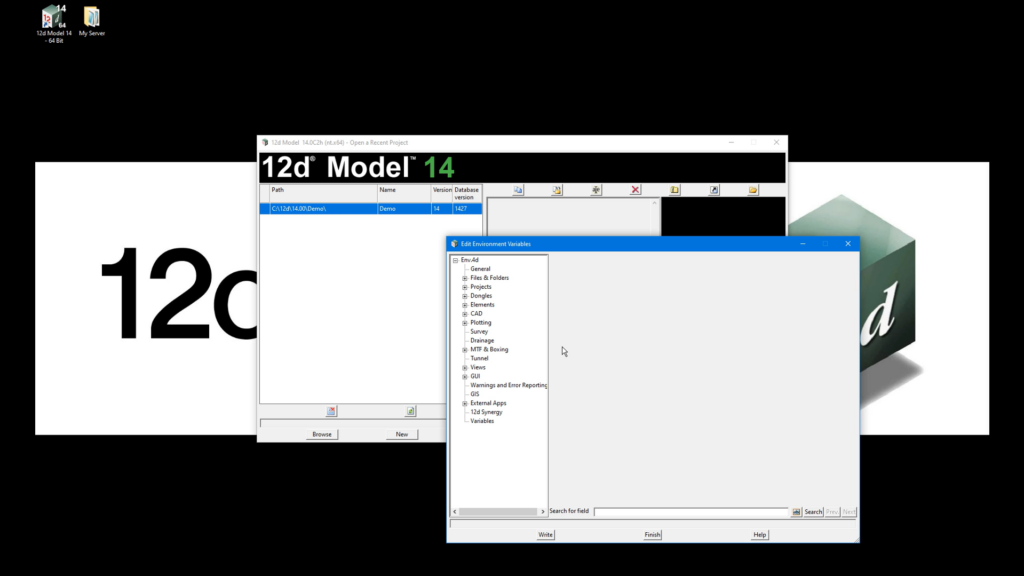
The Tipster: Setting Up Dongles.4d File

In this short but important tutorial, we explain how 12d Model accesses licenses using CodeMeter dongles and how a simple configuration file can help the software locate a valid license.

Whether you’re using a standalone dongle connected directly to your workstation or a network dongle shared across multiple users, understanding how 12d Model searches for licenses can help prevent setup issues and save troubleshooting time.

You’ll also learn about the dongles.4D file, which controls where 12d Model looks for a license and in what order. While standalone users typically won’t need to modify this file, it plays an important role in networked environments.

Watch the full video for a clear walkthrough of dongle-based licensing and learn how to ensure your 12d Model installation is configured correctly from the start.

History Files: North Kiama Bypass – Roads and Maritime Services NSW

For the North Kiama Bypass project in New South Wales, Australia, RMS NSW, with Project Design Supervisor John Burns, utilised 4D Model to rapidly develop an award-winning interactive presentation that supported planning approvals, enabled real-time design evaluation, and showcased the power of digital modelling in complex transport infrastructure projects.

A presentation on the proposed North Kiama bypass, developed by the RTA (Roads and Traffic Authority) Wollongong’s Technology Branch using 4D Model civil and surveying software, has won an RTA Technology Merit Award for outstanding achievement. The presentation, using a laptop computer and overhead screen, was produced for the Commission of Inquiry into the bypass and according to John Burns, Project Design Supervisor, RTA Wollongong, it was received extremely well by all present.

“And what was even more pleasing was that the whole presentation was developed in under four weeks to meet a very tight deadline,” said Mr Burns.The North Kiama bypass project had been going on for around 10 years, due largely to the fact that it impacted on an environmentally-sensitive wetlands area. The local council had refused to approve the project, so it had to be put in front of a public hearing, or Commission of Inquiry, in order to gain State Government approval. The RTA received notification that the Commission of Inquiry would take place in six weeks time.

“We had to decide in a hurry how we would prepare our presentation,” said Mr Burns. “We had to come up with something which could be done quickly but which would be accurate and also be ’live’ so that we could answer ’what-if’ questions on the spot.

“We were long-term users of Moss for road design work,” he said. “It’s a good design tool but not one which you can use for quick and accurate concept work, which was what was needed as we had to present the Commission with options for the bypass route.”We had seen 4D Model previously, so knew it was exactly what we needed to do such a job in a hurry. To make sure it could be done, we asked Lee Gregory from 4D Solutions to come down and carry out an on-site demonstration of the capabilities of 4D Model.

“We then produced a quick business plan submission and obtained approval to purchase the software. It was installed quickly but by now we only had four weeks left to go until the Commission of Inquiry. We knew that, with such an extremely tight time-frame, we would not have time to train-up on 4D Model ourselves, but we had a competent operator elsewhere in the RTA in the form of Ray Tester from our Wagga Wagga office, who was a very experienced 4D Model user. Ray was seconded, on a part-time basis, to help us out, and things got underway,” said Mr Burns.

The initial steps for the RTA were to obtain digitised contour maps of the area, plus cadastral information and aerial photographs to locate and define vegetation limits and sensitive wetland areas. This information was used to start building up layers using Microstation to create the base model. This base model was then put into 4D Model and detailed concepts, interchange layouts, earthworks, boundary details and options were established.

“We wanted to be prepared from the first day of the Commission to be able to answer any design questions and present alternatives for the Commissioner, the members of public and the RTA personnel present, in a quick, accurate format,” said Mr Burns. “With 4D Model we were able to do this very quickly and present the updated information on screen.

“Everyone was very impressed with the speed and quality of the presentation,” he said. “4D Model also allowed us to do a walk- and drive-through video presentation, which helped clarify everyone’s perceptions of what the bypass would look like and, we believe, helped with the final decision. Ray Tester’s skills in the use of 4D were crucial in the design and presentation of this project. He obviously did a great job, as not only was the reception at the Commission excellent, but we subsequently received the RTA Merit Award.

“We are, of course, still using 4D, and we now have two licences servicing 15 workstations,” said Mr Burns. “I can’t praise 4D enough and their product support is also great.

“We used to produce our initial concepts by hand from contour plans then go into Moss,” he said. “This was satisfactory for simple jobs but created problems with complex projects. Now we start with 4D Model and produce the horizontal and vertical geometry, earthworks and cross-sections then go into Moss for the final design, and we obtain a much better result. We are currently investigating the purchase of software which will enable us to scan ortho/topo maps, build up a 3D model from this and then use 4D to produce an electronic, instead of a hand-produced, concept,” he said. “Then we’ll see an even bigger improvement”

Download this Case Study as a PDF HERE.

The 12d Tech Forum is Turning 21! 

Way back in 2005, when we first began hosting the 12d Tech Forum (which was then called the 12d User Conference), we had no idea the event would have such success and longevity. 

In 2005, we were thrilled to have the support of 291 12d Modellers joining us in Brisbane at the Convention and Exhibition Centre (BCEC) we’ve come to think of as a second home. Back then, the Centre itself was much smaller, too! 

Flash forward to 2024 and we were not only in a bigger section of BCEC – the Boulevard Level, which we’ve used for our events since 2012 – but we’d sold it out completely! Over 630 delegates moved around those hallowed halls over the three days of that event, and we could not have been happier. 

And now, as we prepare for our 2026 event, we’re so excited to be moving into an even bigger space – upstairs on the Plaza Level…and to be celebrating the 21st birthday of our event! 

We’d love to see you there to celebrate the 12d Tech Forum ‘coming of age’ – register through 12dtechforum.com today! 

Image credit: EsterFoster

The Tipster: Installing Dongle Drivers 

Before installing 12d Model, it’s helpful to understand how its licensing system works. This video gives you a clear and simple explanation of the different dongle types you may receive after purchasing your license.

Upon purchasing a 12d Model licence or licences, you’ll usually receive: a standalone Codemeter or a network Codemeter dongle (or both).

Standalone dongles come in several forms such as an SSD card, a stubby USB, or a long USB drive. While they may look different, they all serve the same purpose. These are designed for individual users and allow access to multiple projects, with the option to be shared when needed.

For team environments, a network dongle is used instead. This is typically a heavier metallic USB device, where each licence allows one user to access a project at a time, making it suitable for shared organisational use.

By the end of this video, you’ll have a clear understanding of how each dongle type works and which one applies to your setup.

Watch the full video to get a simple, visual guide to 12d Model dongle types and licensing.

History Files: Sydney Olympic Arena Checks in with 12d Model

For the Millennium project at Sydney Olympic Park, contractor Graham Wirth and Abigroup (now Lendlease – https://www.lendlease.com/au/) leveraged advanced 12d Model technology to deliver precise on-site quality assurance for the construction of Australia’s largest indoor sports and entertainment arena in NSW, Australia.

On-site quality assurance checking of all steps in the construction of Australia’s largest indoor sports and entertainment centre is being carried out through 4D Model (later renamed 12d Model).

Architectural and engineering service models are being fed on-site into a 4D survey model to ensure that construction of the Multi-Use Arena at Sydney Olympic Park, Homebush, goes exactly according to plan.

The Multi-Use Arena is being designed and built by construction giant Abigroup Contractors. As well as being a key venue for the Sydney 2000 Olympic Games and Paralympic Games, it is expected to meet Sydney’s sporting and entertainment needs well into the future. Abigroup will operate the facility for 30 years through its control of Millennium, the management company for the Arena.

The fully roofed Arena has a 48 x 75 metre event floor which is surrounded by five levels of seating which can accommodate up to 20,000 spectators. The performance space is free of columns, which provides an uninterrupted view from all seats. There is also a large rehearsal hall with retractable seating for 900. The Arena is adjacent to a 3,500 space car park, also being built by Abigroup, which will be shared by other facilities at Homebush Bay.

Abigroup’s Chief Surveyor, Graham Wirth, said the 4D Model software was rigorously tested in an on-site trial before the company committed to long-term purchase. “The software is being used for survey file management, calculations and storage of as-constructed information,” he said. “During the trial period we found 4D Model superior to other systems in terms of speed, file handling and ability to transfer data to and from other packages. It is now coping with a huge amount of data and performing admirably.” 

Drawings and 2D files are supplied to the on-site surveyors, who put the files into 4D Model and convert them to 3D. The data in these files is compared with on-site survey information models built in 4D Model so that there are no possible clashes in the siting of engineering services, such as storm water grease lines and telecom lines, and structure positions, such as piling.

On-site survey information is collected using the TPSETOUT survey software package which links directly into 4D Model. TP-SETOUT records field data and compares the measurements to design parameters for setout and QA (quality assurance) purposes, then the data is compiled in 4D Model for quantity computations, data storage and transfer, and design modifications.

“The data is put together in 4D Model in layers, which is an excellent feature for visualisation,” said Mr Wirth. “Another good feature is the ability to use very long file names to enhance file management. “We are currently checking ground slabs in 4D model and are using around 30 layers at the moment for all our data,” he said. “We expect that by the time construction is finished in August 1999 this will at least double.

“4D Model is proving an excellent tool for handling very large project models. Our models currently contain about 60,000 to 70,000 points and this should at least double,” he said. “We’re confident that 4D Model will successfully see us through to the end of the project.”

Download this Case Study as a PDF HERE

History Files: Waterman floods the UK – Waterman Civil & Transportation Group

In collaboration with the Environment Agency in the United Kingdom, Waterman Group utilised 12d Model to undertake a detailed flood risk assessment for a major 3,000-home development, streamlining complex data workflows, enhancing analysis precision, and supporting effective planning outcomes.

Waterman Civil & Transportation Group (WCT) was one of the original 12d Model software users in the UK and have finalised an initial study for a housing development of 3000 homes at Waterlooville on the South Coast of England.

This study involved a detailed assessment of flood risk in the area. The Environment Agency had done rough flood outlines based on a 50m grid using the Flood Studies Report, but a detailed assessment was required for planning to determine the existing flood plain and to compare this with another ‘post development’ flood study.

For cost and speed, aerial photogrammetery was ordered to cover the entire site and local surveyors were used to locate the property boundary using traditional means. The resultant photogrammetery (dgn format) and boundary (dxf format) were merged into a single 12d digital terrain model of several hundred thousand points.

To obtain finer detail of the river and to verify the model of the plain, further detailed river cross sections were then surveyed. In the office, work began on building the HEC RAS project inside 12d Model.

After ensuring concurrence on hydrological methodologies with the local Environment Agency office, WCT carried out the back water hydraulic study. Graduate Engineer and 12d user Richard Russell said, “Using 12d with HEC RAS I was able to devote more time to sensitivity tests in HEC RAS and in 12d. I had the luxury of time to try different roughness coefficients and to test if ground cover picked up with the photogrammetery had a significant impact on the results. This gave us better confidence in the final results”.

In addition to creating the HEC RAS project, 12d Model was used to present the water level results. Detailed drawings were produced for submission to the Environment Agency. Internally the visualisation abilities in 12d allowed quick checking at all stages including the final water levels.

Project Director for WCT, Stuart Aldridge, commented, “12d cut the time taken for this type of study significantly. This was the first time we had used 12d for flood modelling and we were very impressed.

“Previously, significant resources were devoted to what I now view as laborious and unnecessary data entry. We also get to use survey data at a much earlier stage, which is proving useful on such a big development. We still propose a detailed survey for a later date, but for now our client can defer the significant cost of the survey until much later.”

While WCT and their client were benefiting from using 12d Model on this project, the two other parties involved also had the opportunity to see 12d in action on a live project. Although both have different interests and uses for 12d, surveyors Julian Brotherton & Partners and the Environment Agency were both impressed with 12d’s quick manipulation of data and 3d abilities. Within a few months both parties became 12d users themselves.

Download this Case Study as a PDF HERE.
History Files: Main Roads working smarter, designing faster

ROADTEK Consulting Services (https://www.tmr.qld.gov.au/), led by contractor Wayne Hansen, successfully leveraged 12d Model to streamline the complete survey, design, and construction setout process for the Marburg Rosewood Road upgrade project in Queensland, Australia.

When surveyors from Queensland’s Department of Main Roads ROADTEK Consulting Services were requested to survey a road corridor on Queensland’s Marburg Rosewood Road, some 60km west of the Brisbane CBD, they elected to use 12d Model and Fieldbook 2000, which has set a new benchmark in the presentation of survey information.

Prior to using 12d Model, survey information was processed using CivilCAD or Geocomp and the project was designed using MOSS and AutoCAD. Setout for construction was always manual input from construction plans.

For this project, features and terrain details were captured using a Geodimeter 610 Total Station. The raw survey data was processed using 12d Model to produce the Fieldbook 2000 verification plots and the 12d ascii files for the design team.

The existing and relocated services were also provided in a 12d ascii format using ‘super string’ attributes. “On the Marburg Road construction project, Main Roads surveyors used 12d in the field for the actual setout of the control lines, drainage structures and roadside furniture,” explained Wayne Hansen, Supervising Engineering Surveyor, Queensland Main Roads.

“All this information was accessed via their laptop computers. Using macros, relevant information was converted into suitable formats for direct uploading into the survey instruments. This eliminates the chance of introducing transposing errors which could have occurred previously as all the data was input into the instruments manually,” he said.

“I believe this is the first time that the whole process has been completed using only one software package.” A part of the project in which 12d was instrumental involved replacement of an existing timber bridge over Black Snake Creek with a skewed 3/3600×2100 RCBC on a realigned section of road reconstruction. The reconstruction works involved removal of existing seal, scarifying existing pavement and spreading it to a new width and crossfall profile, and incorporating additional pavement material to provide a finished full-width seal 100mm higher than the existing one. The design also required realignment of two intersections.

Drainage was also updated using 12d Model to determine excavation quantities and 12d stream x-sections were used to calculate stream tail water depths. The software was used to measure power pole distances to the new edge line which was used in the process to determine relocation works of power poles from the clear zone. 12d Model provided all required outputs to enable service conflict locations to be priced and relocated prior to construction.

Service Super Strings enabled any long section or crosssection to be developed showing comparison between design/subgrade ‘boxing’ surfaces with services. Earth works and pavement quantities were calculated using both the x-sectional area method and tin-to-tin method. The perspective view was used with the drive-through option to view the x-sectional strings and final design which included ground surface and design surface combined as a super tin. This enabled a check of input and the software enabled sight distance to be monitored. The Digital Design Model created with 12d Model also allowed designers access to information as required.

“The actual setout is streamlined, volume calculations can be determined quickly and accurately and underground services can be viewed on screen, allowing clearances from proposed excavations to be checked before the machines cause damage,” a spokesperson explained.

“With the perspective view in 12d Model, job personnel can actually be driven through the completed project before work starts. This is a great benefit, as they can visualise the finished job. “The digital model eliminates transcription errors by the designers and the transposing errors of the surveyors.

According to Wayne, “12d Model is stable, reliable and easy to use and, in Main Roads instance, the incorporation of macros and user menus written by our staff have further streamlined work practices.”

“12d Model helps us work smarter, design faster,” he said. “Whereas other companies seem to be reluctant to improve their software, 4D Solutions is continually improving its offering, particularly in the area of ‘super strings’.”

Queensland Department of Main Roads has an installed base of 130 licences of 12d Model to date.

Download this Case Study as a PDF HERE

History Files: 12d Model streamlines subdivision design – Jacobs (then Sinclair Knight Merz)


The Fini Group project in Western Australia, Australia, was delivered with Sinclair Knight Merz now Jacobs as consultant and Steve Park as contractor.

Mindarie Marina Aerial October 2013

4D Model (later renamed 12d Model) software has proven to be a “quick, powerful and effective tool” in the design disciplines required for the ongoing construction of Mindarie Keys, a major subdivision and marina development in Perth’s northern suburbs. Located about 30 minutes from Perth on the Sunset Coast, the development is an ongoing project of leading multidisciplinary engineering firm Sinclair Knight Merz (now part of Jacobs Group). The firm operates Australia-wide with offices in all capital cities and many regional centres, as well as in South East Asia, the Pacific, and Europe. The Perth office has a staff of more than 200.

The Mindarie Keys project has been underway for around 10 years and is expected to be finalised in another three to five years, with approximately 60 percent completed. The development offers some of Perth’s most attractive land, much of it overlooking the ocean and marina.

To date, the estate includes residential accommodation, a resort hotel, a marina, shopping centres, cafes and restaurants, and three primary schools. A private high school is currently under construction. Sinclair Knight Merz has been involved in the project since its inception.

The design for the subdivisions involves detailed bulk earthworks, roadworks, drainage, and services design to create attractive sites that maximise the varying terrain levels and views. According to project designer Steve Park, powerful software was needed to manage the large data sets required to optimise earthworks modelling for a project of this scale.

Initially designed for fast preliminary design of major roadworks, 4D Model is capable of handling projects in excess of 1,000,000 points, with 200,000 points already considered small to medium-sized. This capability was one of the key factors that attracted the firm to the software during its evaluation process.

“We were previously using a number of packages but with several large jobs coming up we wanted something which would handle more data intensive applications. We evaluated a number of packages then trialled 4D Model for a month. It met our needs and requirements, initially for the Mindarie Keys project, but then also for other large subdivision contracts we had,” Mr Park said.

“It is quick and very powerful for road design and intersections and we can put our drainage design into it to create the full model. We’re getting quicker and more accurate quantities and volume figures than before; it definitely makes the job easier. The fact that it handles such a large number of points makes it an excellent tool for large projects.”

“We no longer have to split large projects into sections, which made them more difficult to handle.”

According to Mr Park, 4D Model’s 3D interface simplifies planning of both surface and underground routes, helping identify conflicts with cables, pipes, and other services while improving perspective presentation.

“The interactive user-definable views allow us to work on any model very easily and provide immediate feedback at every stage of the design process. As all commands are transparent, our drafting personnel do not have to change models or open and close different parts of the program. A recalculation facility allows rapid redesign as modifications are made,” he added.

As well as producing earthworks quantities quickly using end area and exact methods, the software incorporates string and template design methods, providing flexibility across projects ranging from rural roads to multi-lane divided roads.

The software also supports:

  • Unlimited alignments
  • Special kerb return functions for intersections and roundabout design
  • Cut and fill analysis modules
  • Alignment, pipeline, and wastewater design modules
  • Custom project tasks through the 4DL programming language and extensive design function library

“Another major benefit has been the willingness of 4D’s developers to respond to our requests for particular features we may need for any jobs. There have been instances when we’ve asked for a feature and they have gone out of their way to build it in for us.”

“4D’s support and ability to respond immediately to our requests has been a significant advantage.”

Download this Case Study as a PDF HERE

History Files: 12d Takes to the Beach – Cardno (now Stantec)

Cardno MBK now Stantec, in partnership with Consolidated Properties Pty Ltd and contractor Robbie Marshall, leveraged the capabilities of 12d Model to successfully deliver the large-scale Casuarina Beach development in Australia while meeting demanding project timelines and complex design requirements.

12d Model was integral to the success of the Casuarina Beach project, allowing Cardno MBK (CMBK) to meet extremely tight deadlines by reducing the huge variety of calculations required on a project of this magnitude. One of the last ‘absolute beachfront’ sites earmarked for development on the Northern NSW Coast, Casuarina Beach will ultimately be home to more than 5000 people.

The development is the project of Consolidated Properties Pty Ltd, a Brisbane-based firm primarily involved in commercial developments. The supply of all engineering and environmental services was contracted to Cardno. The joint project is being developed by CMBK’s Gold Coast office and its Environmental Unit.

The Gold Coast office was charged with completing the designs, obtaining all Tweed Council and Authority approvals, and supervision of the construction for the infrastructure of over 400 lots and tourist resort sites, to be ready for release by mid-2001.

To achieve these deadlines, CMBK had to rely on creativity and innovation, along with the integration of advanced technology with responsive management. CMBK had successfully used 12d Model for earthworks and civil design on the Seabreeze Estate subdivision at Pottsville. The company was then confident in selecting 12d Model for the Casuarina Beach development.

As Civil Designer at CMBK, Robbie Marshall stated: “Software packages such as 12d greatly assist in meeting deadlines. The diversity and speed of 12d significantly reduced the huge variety of calculations required on a project of the magnitude of Casuarina.”

For the duration of the project, CMBK’s Gold Coast office was primarily involved in the engineering design of roadworks, drainage and trunk water mains; the design of over 4km of 200mm diameter sewer rising main; design and reporting on stormwater drainage systems for the overall development, adopting infiltration basins to complement piped and open channel drainage mechanisms; design of a sewerage reticulation system incorporating a regional pump station to benefit Casuarina Beach and adjacent developments.

The 12d Model modules catered for specific tasks involved in these functions, including such capabilities as the alignment module which uses cross-section templates and string design methods to produce roads, canals and other linear earthwork models. Cut and fill volumes are automatically produced for the design.

When adjustments are made to the alignment strings or templates, the 12d Model recalc option automatically removes invalid information and replaces it with the updated geometry and volumes.

According to Robbie Marshall, this is particularly useful when designing roads, swales, storage ponds or any situation where a number of trials are needed to determine the best position for final alignment. The drainage module supports the display of drainage networks, typically those required for new land subdivisions and development projects such as Casuarina Beach. The drainage string itself consists of manholes, joined by straight or curved pipes. Invert levels and pipe grades can be set or modified graphically or by typed input. Manhole and pipe sizes are also user definable.

Robbie explained that earthwork volumes for trenches can be calculated along the selected design line. “The bulk earthworks modelling for Casuarina was carried out using 12d,” he said. “It was an immense task over the 38-hectare site but was significantly simplified using the software.”

Use of the Volumetrics and TIN Analysis capabilities allows calculation of earthworks volumes within a user defined polygon using either end area or exact calculations. Reports of cut and fill areas and volumes are given on a section-by-section basis using the end area method or on a depth basis using prismodial volumes. Depth volumes can be colour coded for validation and plots.

The integration of these features has allowed CMBK to meet its selection criteria. Robbie explained that CMBK wanted to “increase productivity without reducing quality in the design and documentation of urban developments and civil infrastructure projects”.

Highlighting specific features which CMBK found particularly valuable, he cited the increase in speed of road designs due to the fact that preliminary designs could be simply recalculated with the use of template files; time saved using the kerb function; and the string-based design software which allows accurate finish profiles to be obtained.

He added that the software has good interaction with other packages and was easy to learn and to use, even for the non-computer literate.

Download this Case Study as a PDF HERE.